Saturday, September 24, 2022

Ia Orana, Tahiti!

"Ia Orana" means "Hello" in Tahitian. It all runs together when you say it out loud: "Yo-ranna". If you say it in a sing-songy voice you will sound just like the locals do!


All US flights in and out of French Polynesia land in the capitol of Pape'ete, Tahiti, so we booked a few nights at an Airbnb and rented a car so we could see the main island. Our first day with the car we drove the north coast, stopping at several viewpoints including Faarumai Waterfalls.


The water on the north stretch of the coast is deeper and lacks the shallow reefs and calm lagoon waters that give pictures that famous turquoise blue hue. So the coastline here looked a little more rugged than we expected. We could also see the remains of lava flows in the black volcanic rocks along the shoreline.


The main road in Tahiti snakes around the coast of the island. There is only one road that crosses the interior of the island - through the Papeno'o Valley. The road isn't maintained, so you can't drive it in a rental car. Instead you have to book a Jeep or 4x4 tour.
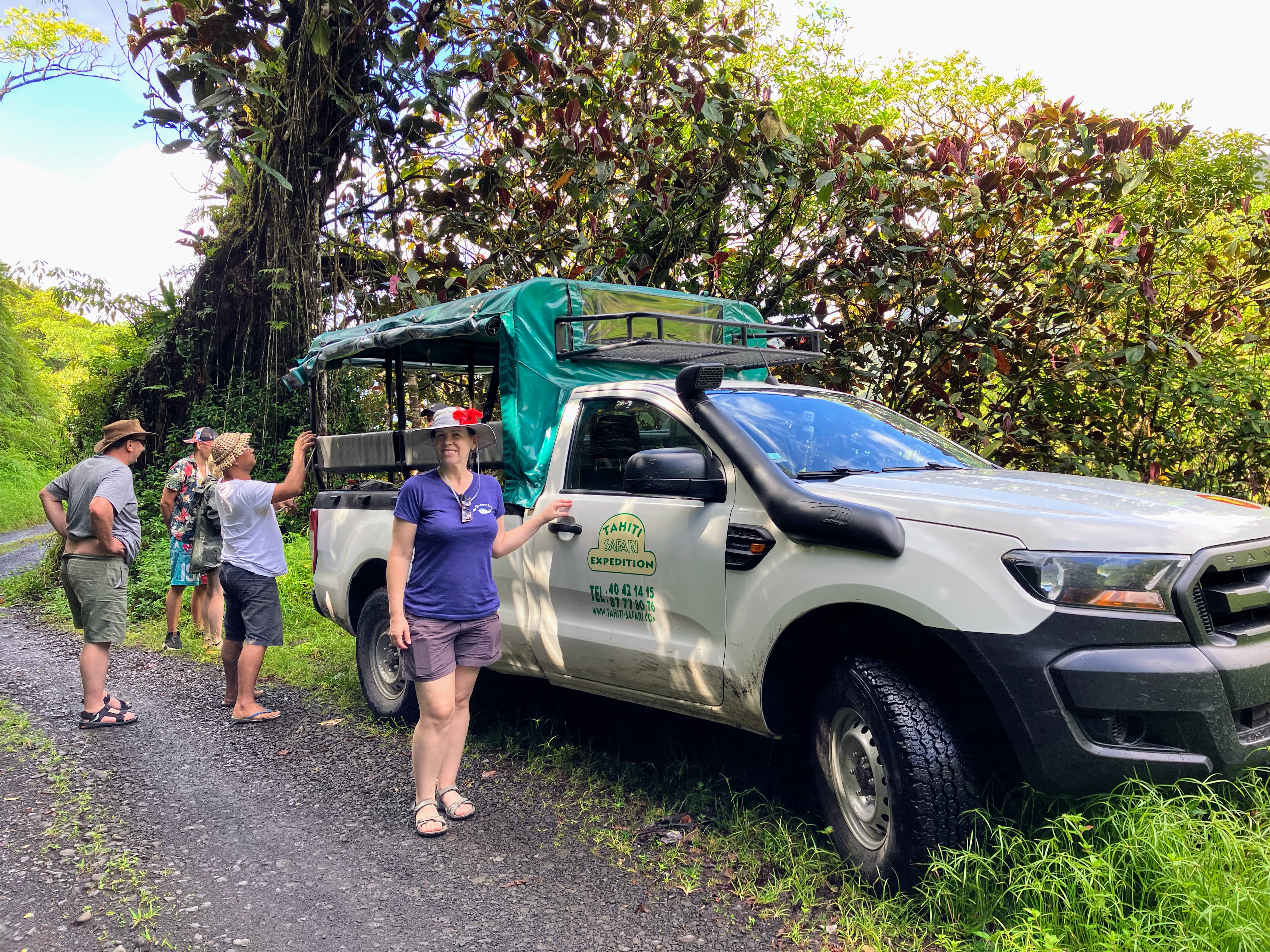

The interior of the island gets tons of rain (Tahiti gets 75 inches annually). It's lush and green and there are waterfalls everywhere you look. We enjoyed seeing the Papeno'o Valley, but it was a long day -- about 8 hours for the whole tour. By the time we got back we were hungry and exhausted.


Luckily the safari tour dropped us off at the town hall in the village of Puna'auia. Just across the street is a public beach where several food trucks serve tasty dinners in the evenings. The food trucks are called "roulottes" and you can find them throughout the islands. They are a little different from our American concept of food trucks that move around -- typically the roulottes have permanent locations and many of them have substantial menus and designated seating areas. Compared to sit-down restaurants, the food at a roulotte is generally less expensive, and we found ourselves eating at them several times during our stay in French Polynesia.


French Polynesia is spread out over a large area in the Pacific and is broken up into five island groups. The island group we are visiting on this trip is called the "Society Islands" and includes Tahiti, Mo'orea, Raiatea, and Bora Bora as well as many smaller islands and atolls. Tahiti is the largest island in the Society Island chain. From the air, it looks like two round blobs of land attached to each other by a narrow neck. The bigger one is to the northwest and is called "Tahiti Nui" (big Tahiti); the smaller one to the southeast is called "Tahiti Iti" (little Tahiti). On the west coast, you can drive down as far as Teahupo'o, where the road ends. This little town is known for the world-class surf break just offshore. This will be the site for the surfing competition of the 2024 Summer Olympics -- almost halfway around the world from the main event in the city of Paris.


We turned around at Teahupo'o and drove back up the Tahiti Iti coast to a seaside restaurant called La Plage de Maui. We had an excellent meal there. Kevin was adventurous and ordered the gourmet plate which consisted of both raw and cooked fish. While Hawaii is known for poke (raw fish marinated in a salty, non-citrus-based sauce), the signature dish in these islands is called "poisson cru". The French name literally translates to "raw fish", and it is made with raw fish tossed in citrus juice and then marinated in coconut milk. In the photo below it's in the round dish next to the rice. And yes - that is a raw shrimp in the lower left corner of the plate. I consider myself a reasonably adventurous eater but I draw the line at raw shellfish. Kevin ate it and lived to tell the tale!


On our way back up the coast we found a nice spot at Vaiava Beach and went snorkeling. Visibility wasn't great, but it was nice to get in the water. We are hoping to see some better snorkeling spots on the island of Mo'orea -- our next stop!


Monday, July 18, 2022

Southwest Road Trip: Calistoga Wine Weekend

Side trip! While we were staying in Lake Tahoe, we realized it was just a short three-hour drive to the Napa wine region in California. This would normally be a 12-hour drive from our house in Arizona, so we thought it would be worth it to take a short weekend side trip from Tahoe.


We arrived in the Napa region just in time for lunch. It was a Saturday, so there was some traffic as we wound our way north on the St Helena Highway through the vineyards. The familiar names on the winery signs were tempting, but our first destination was a spot more known for its burgers than its grapes -- Gott's Roadside. They had a really nice outdoor picnic area and the burgers were absolutely delicious.


Since I prefer my wines with bubbles, we had booked an afternoon tasting at Mumm Napa. It did not disappoint! We had excellent service and loved the generous pours of various sparkling wine varieties. Definitely a good tasting room to visit if you have something to celebrate, like a birthday or anniversary. Or if you want to just celebrate life in general by drinking some sparkly wine with a fabulous vineyard view!


Another winery we really liked was Vincent Arroyo. The tasting room had a very casual vibe, but they had so many varietals available to taste or to purchase -- Chardonnay, Sirah, Cabs, Merlot, Sangiovese, Zinfandel and even a Port. So of course we definitely had to try the port, having just been to Porto and the Douro valley last November -- it was actually pretty good, so we picked up a bottle to bring home with us.


Just like everywhere else in the Southwest this summer, the Calistoga area was experiencing an unusual heat wave. Definitely a concern for the grapes currently on the vines, although the ones near the Vincent Arroyo tasting room looked okay to us. Kevin tried one but it wasn't very sweet -- there's a reason they differentiate between wine grapes and table grapes. Too many seeds for me!


This trip was mostly about the wine tasting, but we did get tickets to a wonderful evening of jazz at the Charles Krug winery. Bebel Gilberto is bossanova royalty -- she's the daughter of Brazilian guitarist João Gilberto and a world-famous musician in her own right, with four Grammy nominations. She put on a charismatic and delightful performance, and it was wonderful to sip some wine and enjoy the music in such a beautiful outdoor setting.


One of the highlights of our trip was visiting the world-famous Chateau Montelena. The winery is one of the oldest in the Napa Valley, having been established in the 1880s by a man named Alfred Tubbs. 


After prohibition, the winery fell into decline and was purchased in the 1950s by Yort Wing Frank who used the chateau as a vacation home. He improved the landscape around the chateau by excavating Jade Lake and building a beautiful Chinese garden. It is a very peaceful spot -- we sat and watched the swans for a bit after we finished our tasting.


But the primary reason that Chateau Montelena is world-famous is because of the "Judgement of Paris". In the 1970s, the Barrett family replanted the vines and began producing wine again. There was a wine competition in 1976 that pitted the upstart American wineries against the old guard French wineries from Bordeaux and Burgundy. In a blind tasting, the 1973 Chateau Montelena Chardonnay was ranked above all the other white wines. (Stag's Leap Cabernet Sauvignon, another American wine, won the honors in the red wine judgement). This competition put the Napa region on the wine map, so to speak. There is an excellent movie about this competition that we saw a few years ago called "Bottle Shock". Having tasted the wines from Montelena, I can agree that they live up to their reputation!


With our wine weekend trip coming to an end, we visited one last winery - Bennett Lane. It was probably the friendliest and most down-to-earth tasting experience we had on this trip. Our host Bill was incredibly knowledgeable about the history of Calistoga and the local wineries, and he made sure we had a wonderful experience tasting the wines. By the end of our visit it was like we'd been sitting talking with an old friend.


Calistoga is a town full of charm and we had such a nice getaway here in California wine country! I think this photo sums up our time here very nicely:

Friday, July 15, 2022

Southwest Road Trip: Lake Tahoe

From Great Basin National Park, it was a long and very boring drive across the entire state of Nevada to get to Lake Tahoe. There were so few cars on this stretch of road and the rest stops were few and far between. We were thrilled when we finally hit civilization again and got our first glimpse of the crystal blue waters of Lake Tahoe.


The original inhabitants of Lake Tahoe were the Washoe Native Americans, who have lived in the area for 10,000 years. White settlers didn't arrive in large numbers until the Silver Rush of the 1860s. The 1860s also brought the railroads, which brought even more people out west. For many decades, the lumber industry was king in this area, but in the early 1900s wealthy families began buying forest land around the lake to build fabulous summer residences.


In 1928 Lora Josephine Knight, one of the wealthiest women in America, decided to build a Scandinavian-inspired mansion in Emerald Bay. She and her architect traveled to the Nordic countries and took inspiration from Norwegian stave churches and Swedish castles to build the house she named "Vikingsholm". We took a guided tour of the home, which is now a museum.


The tour showcased the guest rooms as well as the staff rooms. There were many beautiful Scandinavian antiques and other Nordic-inspired furnishings, like "Selma" the clock.


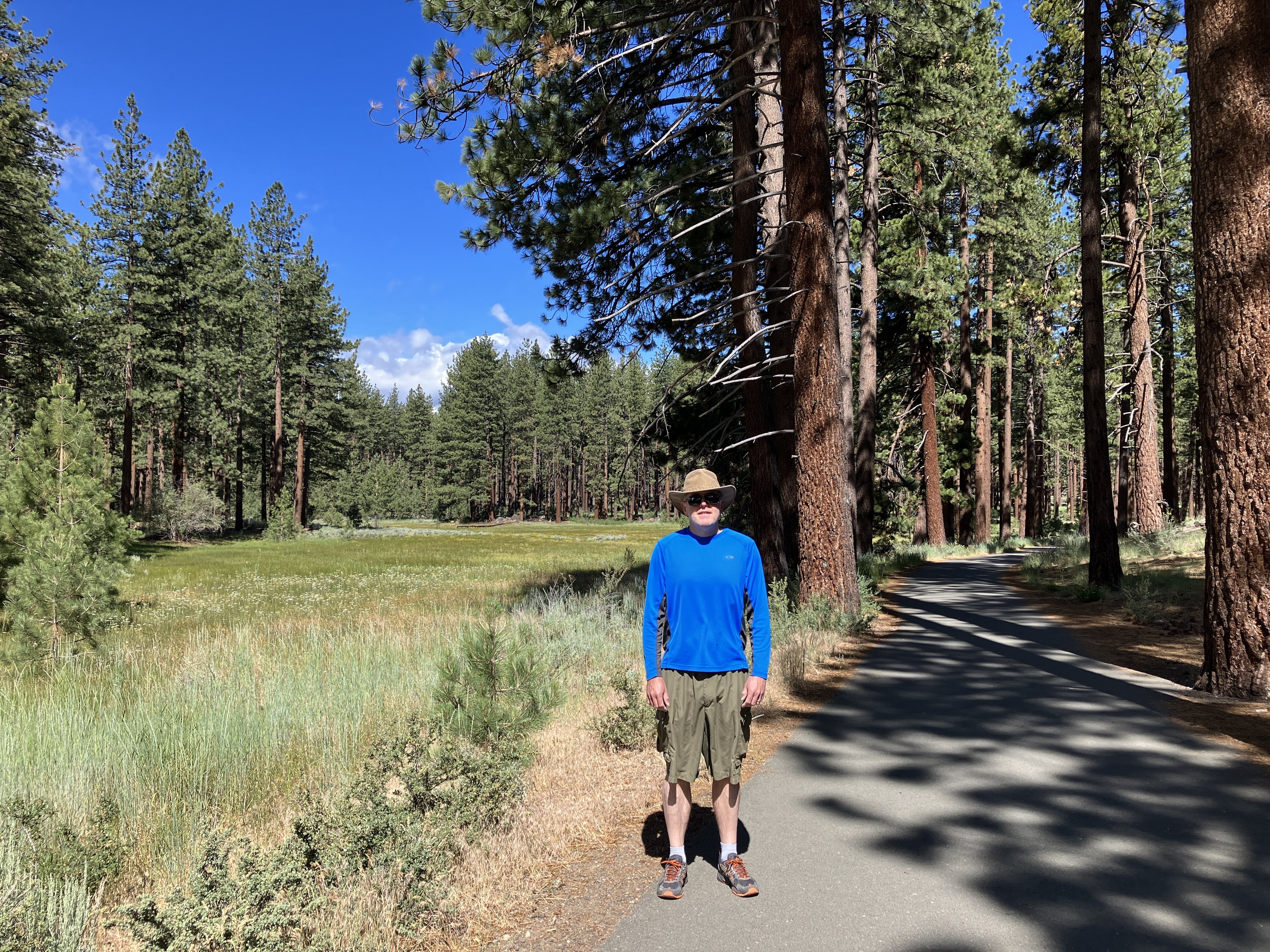
We loved how much of the land around Lake Tahoe was preserved as natural forest or open meadow. The Lam Watah Nature Trail meanders through Rabe Meadows and the surrounding woods. It was a very scenic way to walk down to Nevada Beach from where we were staying.


Also near our lodgings was the Heavenly Ski Village. Even in summertime it's a lively place, with lots of bars, restaurants, shops, and activities. It was a great place to have a beer and listen to live music.


We found plenty of great hiking trails all around the Lake Tahoe area. Many trails lead to the smaller alpine lakes that dot the landscape. One of these is the Fallen Leaf Lake trail.


We saw very few people on the trail, but the meadows were full of brightly colored wildflowers.


And the forest was thick with old-growth redwoods and pines. This tree looked like it had been struck by lightning in the recent past.


Another excellent trail was the Rubicon Trail. We hiked two sections of this trail on separate days -- one hike took us along the south shore of Emerald Bay to Vikingsholm, and the other hike took us down from Lester Beach to the north side of Emerald Bay along the prettiest aquamarine stretch of water.


We passed a couple of hikers that had just seen a bear near the trail, and sure enough, we managed to see it too! Well...actually Kevin saw it and tried to point it out to me -- I just saw its rump as it scampered off into the forest. I was too slow to catch a photo of the bear, unfortunately.


After our Rubicon Trail hike, we headed up to Tahoe City for lunch and enjoyed walking around the town. There are 63 creeks and tributaries that feed into Lake Tahoe, but only one flows out -- the Truckee River. The flow on the Truckee river is controlled at the dam located in Tahoe City.


So we didn't get a photo of the actual bear that we saw on our hike, but we did see this enormous bear sculpture in Tahoe City and couldn't resist taking a picture. The sculpture is called "Ursa Mater" and her fur is made up of over 200,000 pennies!


Later in the week, we drove up the eastern shore of the lake and stopped in at the viewpoint of Sand Harbor. Many iconic Lake Tahoe photos have been taken from this spot. 


Continuing our drive north, we tried to stop in Incline Village for lunch and a stroll on the beach but we discovered that all of the beaches here are private, which was irritating. So instead of eating lunch there, we continued to Kings Beach at the very north end of the lake. We found a great lunch spot, Jason's Beachside Grille, overlooking the long stretch of public beach.


Having seen it from the roadside viewpoint, we knew we wanted to head back down to Sand Harbor to enjoy what we thought was the prettiest of all the Lake Tahoe beaches. Sand Harbor is a popular state park with limited parking, and even on weekdays they often run out of parking spaces by 9 or 10am. So one Friday morning we got up super early and headed to the park entrance. We arrived just after 7am and there was already a looong queue of cars waiting to get into the parking lot. We scored a spot easily, but we later found out that the parking lot filled up completely by 9:20 am that day, wow! We rented a kayak from Clearly Tahoe's beachside kiosk and paddled around for about two hours just enjoying the early morning sunshine and the crystal clear turquoise water.


Sand Harbor has a really well-run concession area, with a full lunch menu and a bar offering tasty beach cocktails. We had a wonderful afternoon lounging in the shade and reading while sipping on some very delicious Mai Tais.


The water was a brisk 70 degrees. Too cold for me to want to swim, but I did enjoy getting my feet wet. Spending the day at Sand Harbor was probably the highlight of our Lake Tahoe trip and we would highly recommend it -- just be sure to get there early!

Sunday, July 3, 2022

Southwest Road Trip: Great Basin National Park

Great Basin National Park is on the very eastern edge of Nevada where it borders Utah. It's one of the most remote National Parks in the country -- on the drive here we encountered maybe a handful of other cars. The reason for the strange name "Great Basin" is that this region of the United States offers no outlet to the sea. In Central Nevada the rivers and streams flow inland and eventually evaporate from shallow lakes and mud flats because of the arid conditions.


But the park itself gets heavy snowpack thanks to its proximity to Wheeler Peak and the mountains here. Our campsite in Upper Lehman Campground was surrounded by plenty of lush tall trees that provided ample shade. Unfortunately we had to set up the tent here twice because the first time we forgot to sweep away some of the sharp and small pine cones and rocks -- ouch! Good practice, I guess!


Our site was right next to the Lehman River. A tranquil spot for reading a book or having a glass of wine at sundown. We did see deer coming through here on several occasions.


Because of its isolated location, Great Basin is a Dark Sky park -- there are no big towns or cities nearby, making this a wonderful spot to stargaze because there is minimal light pollution. The excellent ranger program was a great introduction to stargazing -- they set up three Celestron telescopes so that everyone had a chance to see the stars after the sun went down. We were there on a fairly clear night and the Milky Way was plainly visible with the naked eye.


Another feature of the park is the Lehman Cave system. You can go into the caves on one of the guided tours, and it's best to book ahead because they sell out. We got lucky and were able to upgrade our pre-booked 30-minute Gothic tour to the longer 90-minute Grand Palace tour that explores all the open sections of the cave. 


There are lots of hiking options in this park, but it is definitely high-altitude hiking. The brave (and very fit) can hike to the summit of Mount Wheeler (13,063 ft), which is above the treeline and involves quite a lot of scrambling over rocky scree and talus. We opted for the still-challenging but less fatiguing Bristlecone Pine-Glacier Trail.


The Bristlecone Pine trees in this grove are nearly twice as old as the ones at Cedar Breaks. Note how the wood of the trunk twists and curves.


We went as far as the rock glacier, which sits at 11,500 feet elevation in a cirque just below Wheeler Peak.  This glacier is mostly covered in rock and is one of the southernmost glaciers in the U.S. It is Nevada's only remaining glacier.


We did several other hikes including the loop that goes past both Stella and Teresa Lakes. We were glad we had the opportunity to visit this remote park, it was definitely worth the long drive and far off the beaten path!

Wednesday, June 29, 2022

Southwest Road Trip: Cedar Breaks National Monument

 As we headed through the mountains to our next destination, dark clouds started gathering. We arrived at Point Supreme Campground in Cedar Breaks National Monument and knew we would have only moments to set up some shelter before the downpour. It's a big tent with a lot of complicated parts -- it usually takes us about an hour or so to get it all set up. This time, running at full speed we managed to get it completely set up in less than 30 minutes -- a new record!


Which was a really good thing, since we had only a minute or two to spare. As soon as we were inside, it started pouring and didn't stop for about two hours! Luckily I'd grabbed our bags with our e-readers so we could at least do some reading while we waited for the rain to subside.


Once the skies cleared, we did a little bit of exploring by car to see the views into the amphitheater. Cedar Breaks is near the top of the "Grand Staircase" -- exposed layers of rock that begin at the base of the Grand Canyon, up through the formations of Zion National Park, and ending up at about the same elevation as those at Bryce Canyon. It really does look like a smaller (and less crowded!) version of Bryce Canyon because both parks are part of the Claron rock formation. The rocks are a similar orange-red, and the same weathered "hoodoo" formations can be seen at both parks.


We just happened to arrive at Cedar Breaks for their Wildflower week -- it seemed like the entire park was in bloom with a huge variety of wildflowers. We made sure to go on a ranger-guided wildflower walk so that we could learn all the names of the flowers we were seeing everywhere.


Which I promptly forgot, of course! I did look this one up -- it looks like a Variable Checkerspot butterfly pollinating some kind of yellow Cinquefoil flower.


There were so many flowers that even our ranger was stumped for the names of some of them. The only one I still remember without looking it up is the Colorado Columbine. On other hikes we saw lots of white ones and even a few lavender-blue ones.


We did two long-ish hikes while we were in the park. the first one was the Alpine Pond loop trail. While it didn't have many views of the canyons or ridges, there were tons of trees and wildflowers to look at. And as its moniker would suggest, it did lead to an alpine pond.


On our second full day in the park, we did the more strenuous South Rim Trail to Ramparts Point. From this hike we had spectacular views of the entire amphitheater. It was truly breathtaking and one of my favorite hikes.


One other unique feature of the Ramparts hike was walking through the ancient Bristlecone Pines at Spectra Point.


Bristlecone Pines are some of the oldest living things on Earth -- some of the trees here are over 1500 years old. They thrive in the most extreme conditions where other trees can't grow -- windy, arid areas with poor soil.


Cedar Breaks is definitely one of the hidden gems of our National Parks system. It gets less tourism attention than the larger parks in this part of Utah (Bryce Canyon, Zion) but it was well worth a visit and we really enjoyed our time here.