Thursday, March 30, 2023

K'gari - Fraser Island

For the past couple days we have been on a two-day tour of Fraser Island (K'gari). It is a large sand island just off the coast of Queensland on the edge of the Coral Sea. There is no bridge, so the only way on or off the island is via a ferry.


On the ferry over, we noticed that we were much, much older than the majority of the passengers. We were surrounded by several throngs of teens wearing "Class of 2023" shirts, chatting away, flirting with each other, snapping photos with their phones. Camping is a popular thing to do on the island, so I just figured they were all there for some sort of school camp. The group didn't come with us on the resort shuttles from the ferry dock, so I thought nothing more of it as we checked into the hotel. For the first night of our tour, we were booked into a very nice room at the Kingfisher Resort. We had a pretty view of a lily pond from our deck. It seemed like a tranquil and relaxing retreat. I had booked a massage at the day spa, and hurried off to that appointment while Kevin headed off to lounge by the pool and read.


An hour later, I left the spa and checked my phone. Kevin had texted the photo below, follwed by a series of several other similar ones. The teens -- all 97 of them, we learned after talking to one of the chaperones -- were not camping elsewhere on the island but were instead staying at the resort all week! Crikey!


Luckily we discovered that they had a set schedule, with very little free time. After a couple hours in the pool, they all mysteriously disappeared to some conference room and we didn't see them again for the rest of the night or the next morning at breakfast. I will say the pool at sunset was much more peaceful than it was just hours before.


The next morning, we packed up our bags and went off to meet our tour. The K'gari Explorer Tours are technically a "bus tour" but it was a bus unlike any other -- a huge hulking machine with enormous wheels. All the roads on the island outside the Kingfisher Resort are rough tracks through the sand. About 25 of us piled into the bus for a trip across the island to K'gari Beach Resort on the western shore.


Like the Kingfisher Resort, the staff at the K'gari Resort instructed us multiple times about the many dangers on the island. (Remember, Australia is always trying to find ways to kill you...) In addition to spiders, snakes, riptides, and other hazards, we had to be on the lookout for dingoes. In fact, dingos are the apex predator on the island. We were told that if we encountered a dingo, we should stand up tall, stay in a group, never turn your back on a dingo, and most importantly do not run away from the dingoes. Both resorts were entirely enclosed inside a "dingo-proof-fence" and we were also directed to always, always close the gate behind us if we left the enclosed compound to go on an evening stroll. Ha! Like we were going to do that, after all the warnings. Kevin joked that it all seemed eerily similar to the instructions given to visitors to Jurassic Park.


The aboriginal name for this island is K'gari (pronounced GAH-ree). After Westerners came it was renamed Fraser Island for a couple hundred years, but recently the island has become known as K'gari again. It is a UNESCO World Heritage site for several reasons - the main one being that it is the largest sand island in the world. Most sand "islands" are just rather big sandbars but K'gari is 75 miles long and about 15 miles wide, making it over 600 square miles of sand. As someone who already doesn't love the beach, I began to wonder if I had made a mistake in coming here. So. Much. Sand.


Getting anywhere on the island requires a four-wheeled-drive vehicle with high clearance that is capable of driving on sand and plowing through a couple feet of water when necessary. You can bring your own vehicle but you do so at your own risk. We wouldn't have wanted to bring a rental car here, but even more ironically our rental company "upgraded" us to a lowriding BMW 220i which is basically the opposite of all the above requirements (they'd run out of the cheapo car model we'd reserved). So we wisely left it parked back on the mainland. 


The shore along the western side of the island is basically a highway. And I mean that literally. Known as "75 Mile Beach Highway" it stretches along the coast with lots of bumps, ruts, and washouts (where a freshwater stream cuts a channel across the beach to the ocean). Sand conditions can be anything from packed hard sand to soft loose sand, to anything in between. Squalls can bring the occasional downpour of driving rain. In addition to these road hazards, there are loads of other pitfalls to watch for on the road: cars coming from the other direction (it's a two-way highway -- keep to the left!), fishermen at the shoreline, tour groups milling around, tour busses making u-turns to look at stuff, dirt bikes, and the occasional dingo. Oh, and of course the posted speed limit is 80 km/h (about 50 mph). People driving their own cars or hired 4x4s who aren't familiar with how to drive in the conditions get stuck all the time, and we saw at least one tow truck whizzing by at high speed.


Did I mention that there are several sand airstrips that also share the highway? 


With all of those hazards to watch out for, we were really glad to leave the driving to our experienced tour guide Warren.


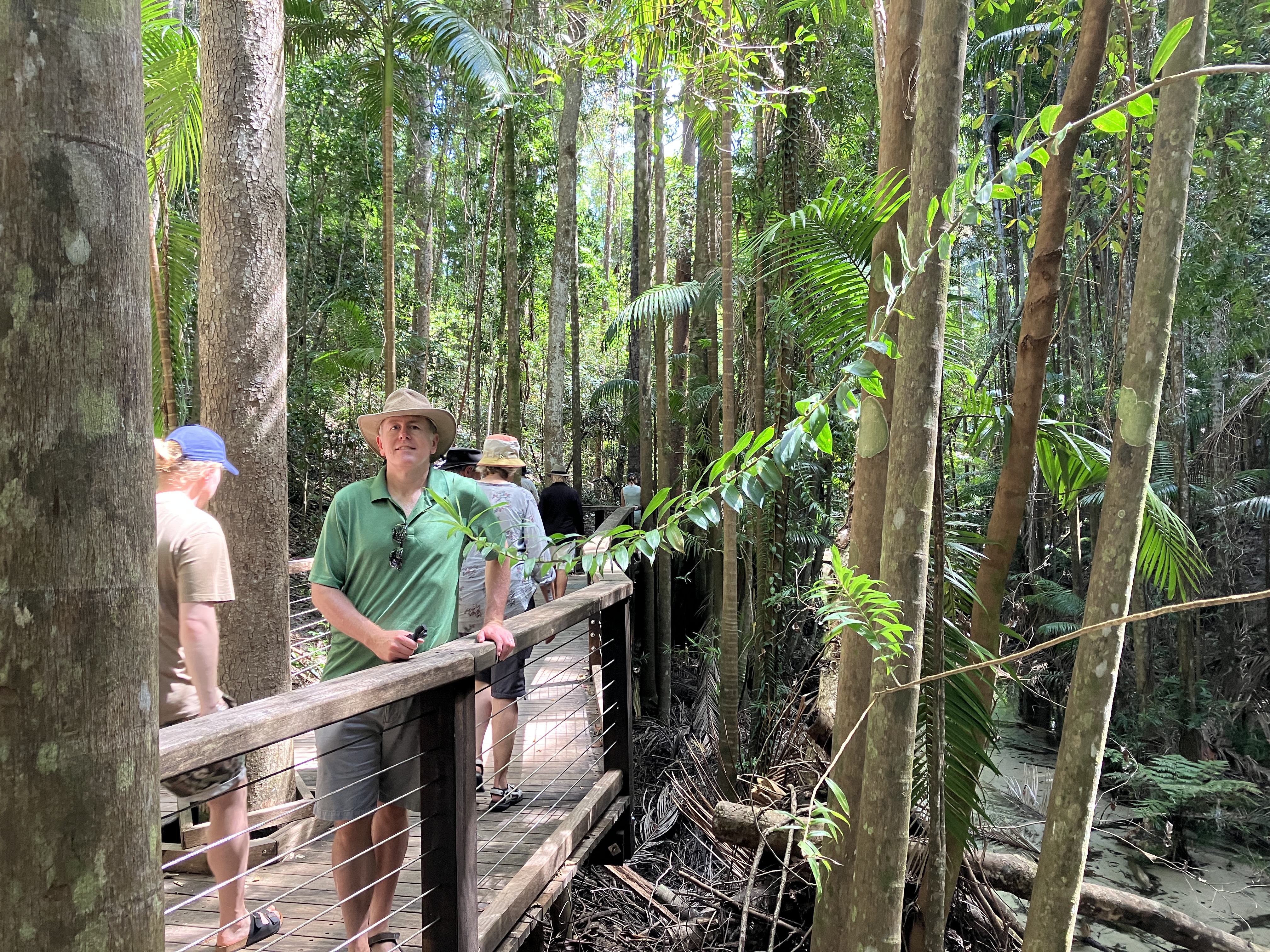
You would think that being a sand island there would be no vegetation, but you'd be wrong. The interior of K'gari is a dense subtropical rainforest full of extremely tall trees. In the 1860's a logging camp was set up on the island and the result of cutting down centuries-old trees has reshaped the forest and left a lasting legacy. The main trees they were after were the "Fraser Island Turpentines" (satinay) -- the bark of this tree is impervious to marine borers (shipworms) that used to wreak havoc on the hulls of wooden sailing vessels. There are still some native hoop pines and satinay trees growing tall, but many were logged and have been replaced with non-native species. So the forest is still densely packed, but the predominant species have changed since the logging camp was here.


How do so many trees grow in pure sand? Well, the sand here is actually coated with minerals that the trees and plants use to get the required nutrients. Fungi, lichen, and rotting vegetation also provide some nutrients but there really is no soil to speak of -- the plants here are just well-adapted to growing in sandy conditions. There are also a few species of epiphyte which are plants that can grow in the air -- they get their water and nutrients from the atmosphere. In this photo you can see some staghorn ferns that look like big round green fans growing right out of the tree trunk. Those aren't part of the tree and they aren't parasitic either -- they just perch on the outside of the trunk and pull what they need to live out of thin air!  


One of the activities on our tour was a grueling afternoon hike up and over an enormous sand dune (entertainingly named the "Hammerstone Sandblow") -- in scorching heat and high humidity. At the end of the sahara-like sandy stretch was Lake Wabby, the deepest lake on the island.


We much preferred another freshwater lake that had a car park, picnic tables, and zero sand dune hiking required. Lake McKenzie is a crystal-clear lake with a truly white sand beach and bottom beneath it. The lake is fed by pure rainwater, not groundwater or stream water as it sits too high above the water table. The water is so pure that it doesn't support much marine life.


There were lots of opportunities to cool off in the heat. After our inland swims on the first day, we also visited the Champagne Pools. These are tidepools where the water bubbles whenever the waves crash over the rocks.  


As the tour continued we saw several signs of dingoes, but no actual dingoes. I was getting concerned because my main reason for coming to this island was specifically to see at least one wild dingo.  


So the search continued...Meanwhile, we explored the wreck of the SS Maheno


Maheno was a luxury ocean liner that ferried people in style across the Tasman Sea from the early 1900s until the first world war. During WWI it was converted to a hospital ship, and then put back into commercial service. Its main route was from New Zealand to Australian ports, although it did make a few trips further afield before being retired. It was actually in the process of being towed to Japan for parts when a cyclone hit on July 7, 1935. The tow line broke and the Maheno was beached on the western shore of Fraser Island. Subsequent efforts to re-float her were unsuccessful and she has remained on the beach, slowly deteriorating, ever since. Here's what she looked like in her prime.


It's a huge wreck, the ship was originally 400 feet long. During WWII the Australian military used it for bomb target practice, further hastening its demise. 


Because of the possibility of unexploded ordinance (and the threat of tetanus from the rusting metal), you cannot walk around inside the ship. If the authorities see you, you will be fined. But the tide was low, so to get this shot Kevin stayed outside the ship but just walked around to the other side of the hull. So no rules were broken!


As we ended the second day and started driving back towards the ferry we finally saw a dingo, a juvenile male just sitting by the roadside. You might be asking, what exactly is a dingo? Dingos are a type of wild canid that originally evolved from the Asian wolf. They were partially domesticated and were eventually brought here to K'gari by members of the Butchella people (the original owners of this island) over 4000 years ago.  Then over time they stopped being domesticated and became feral again. Dingoes are found throughout most of Australia, but because of the isolated location the K'gari dingoes have never interbred with other canines and are more "pure dingo" than those elsewhere. 


As you would expect, there are always issues between these wild animals and humans. The dingoes are very clever, and will use pack hunting strategies to steal food from humans recreating on the island. The resorts have dingo-proof fences, but there are many campgrounds and free-camp places that are open to the wilderness -- there is always some kind of conflict when humans intrude into the wild. When tourists first started coming here, they actually fed the dingoes on purpose. Over time, the original population of 200 dingoes doubled to 400. A law was put into place that made feeding the dingoes punishable by fine. Without an easy food source, the population returned to around 200. 


There have been several incidents over the years where young children have been injured and even killed by dingo maulings. The park service continues to try to educate visitors on dingo safety, and to try to limit human interactions with these wild creatures. Ranger vehicles were stopped near several of the dingoes we saw.


Each dingo is tagged and monitored by the parks service. You can see the tags in the ears -- females are tagged in the right ear, males in the left. 


After three days exploring the island, we had to head back to the mainland and continue on with our trip. We can see why many Australians recommended this island as a "must-see" while here; we had a truly unique experience on K'gari! 


Monday, March 27, 2023

Noosa Heads, Queensland

After a couple weeks of road trips we decided to spend a few days in one place, so we booked a really spacious Airbnb in the beachy town of Noosa Heads, about ninety minutes north of Brisbane. This town has everything you could want in a vacation destination— a fun-loving vibe, loads of restaurants and bars, a couple National Parks, tons of watersport recreation opportunities, the only recognized everglades outside of Florida, and some spectacular beaches. 


As you might expect, this place is very tourist-friendly. It does get crowded and parking can be hard to find, so on weekend days the town has several free bus routes to ease some of the congestion. On Sunday morning (yesterday) we took a free bus ride to the Noosa farmers market to grab some breakfast. 


We found plenty of good things to eat. Some were reasonably healthy, like this avocado toast on multigrain bread. We also bought a couple of papples, which I had never tried before. As the name indicates, they are a cross between a pear and an apple. And then of course we found the French baker and treated ourselves to a not-so-healthy pain au chocolate. We definitely did not leave the market hungry!


We took the free busses all around town and explored a bit on foot, but by early afternoon we were dripping with sweat! We are now in the Australian state of Queensland, which is much closer to the equator than the other Australian states we’ve been to so far (New South Wales, Victoria, and Tasmania). It's a tropical climate here and when the temperatures are in the 80s (Fahrenheit) it feels very muggy with the humidity. Luckily our Airbnb has a refreshing pool! It was so relaxing to spend the afternoon cooling off with a swim. The trees in the garden were filled with colorful rainbow lorikeets chirping away, and we saw an enormous monitor lizard climb through the fence from our yard into the neighbors’. Sorry no wildlife photos this time; we were swimming and couldn’t get to our phones quickly enough!


A long trip like this isn’t all glamorous leisure activities all the time. We did have to spend an hour or so this morning catching up on our laundry at a laundromat across town. But after folding our clothes, we stashed them in the trunk of our rental car and drove a couple blocks to the marina so we could hop on the Noosa River ferry. 


The 45 minute trip down the river was really pleasant. The captain provided interesting commentary about the town and the river. Noosa Heads is a pretty well-heeled place, and there are some very fancy and expensive homes right on the water. 


We got off the ferry at Hastings Street and, inspired by our high-end surroundings, treated ourselves to a fancy brunch at one of the bustling bistros. 


After our meal we splurged again and rented beach chairs and an umbrella at the Noosa Heads main beach to soak up some of the sunshine here on Australia’s “Sunshine Coast”. 


The sand was so soft and the water was the perfect temperature. Usually I don't enjoy swimming at the beach because I don't like wet sand between my toes, but I had to make an exception for this beach! 


From the beach we had a great view of the headlands of Noosa Heads National Park. The waves were crystal clear - you could see the fish swimming around at your feet. Luckily we only encountered small friendly fish — no sharks, box jellyfish, or venomous octopi! Whew, we survived a swim in the the dangerous waters of Australia…this time!


Saturday, March 25, 2023

Friday, March 24, 2023

Port Arthur and Tasman National Park

For our last day in Tasmania, we decided to explore a couple of things on the Tasman Peninsula. One of the definite must-see activities in all of Tasmania is to visit the Port Arthur Historic site, one of the most significant of the 11 World Heritage Convict Sites in Australia.


When Tasmania was known as Van Diemen's Land, it had a notorious reputation as a brutal penal colony. While criminals of all stripes were sentenced to "transportation" to Australia in various other locations, Port Arthur was where criminals were sent if they committed a second offense after arriving in Australia or if they were considered particularly unrepentant and rebellious. It was intended to be an inescapable location for the worst of the worst, kind of like Alcatraz in California. However, there were also some very young criminals detained here -- records show there was a prisoner here aged 9. At that time, anyone over the age of seven was considered old enough to be punished in the criminal system for actions as minor as petty theft or pickpocketing. Here at Port Arthur, boys under 17 were kept in their own prison facility nearby so that they didn't mix with the hardened criminals in the adult penitentiary. For the men and boys here, transportation basically amounted to forced migration and forced labor, and life here in the convict cells was very hard. In the main penitentiary, prisoners were separated by floor: the top floor held 348 men in a big bunk-style dormitory, the lower floors held men in individual cells, sometimes in light irons, and the ground floor had the cells for the most dangerous offenders -- small, dark rooms where they were kept shackled in heavy irons. The photo shows just how small those ground floor cells were -- barely enough room to lie down, each cell separated by a thick impenetrable wall. 


At the visitor center, we were invited to pick from a deck of cards. The card you chose gave you the name of an actual person who lived here at Port Arthur, either as a prisoner or a military officer. In the visitor center, you could look up a few historical facts about your person, and then as you explore the sprawling grounds you look for a marker that indicates that you are in the area where your person lived or worked. I drew a convict named Sarah Evans, a laundress from Wales who was orignally sentenced to ten years transportation for burglary. She tried to escape several times from other Australian prisons, served multiple sentences of hard labor, and ended up sentenced to service here at the Commandant's house.


Kevin of course drew a law-abiding card, instead of a prisoner card. His person was Thomas Coke Brownell, a medical officer who had the bad luck to be stationed here at Port Arthur three separate times. But I made him pose behind bars anyway! 


Most convicts were made to work building ships in the dockyard or as blacksmiths, carpenters, or any other kind of manual toiling labor that needed doing around the prison. Rations were not particularly appealing; you can see in the photo below that it was basicallly just bread for breakfast and dinner. Only for the midday meal did they get anything substantial like meat, potatoes, and vegetables. The card in the photo clarifies that "these replicas are probably more appetizing than the real thing. Meat was often mainly bone and gristle and flour full of weevils". Yep, you read that right: weevils. Sooo.....extra protein?


While the prisoners suffered for their crimes, the officers lived a much more comfortable lifestyle here. Their houses were built and maintained by convict labor, and they had many luxuries. The commandant (the most senior official) lived the most lavishly of all in a plush home at the top of the hill. This is where "my" prisoner Sarah Evans worked, probably washing and ironing the fancy table cloths and napkins you see in the drawing room.


After the site closed in 1877 and ceased to function as a prison, many buildings here were dismantled, sold off, or destroyed by bushfires. From the early 1900s to the 1970s this became a small residential town with a police station and a handful of full-time residents. After the 1970s the National Parks and Wildlife Service took over management and began a project to conserve and preserve the site for tourism purposes. The main stone buildings are mostly left untouched from that time, meaning that most don't have roofs or are just shells of the buildings with a few details added for interpretation (like at the cells in the penitentiary). It does give the whole site an unnerving and somber aspect.


True tragedy struck here in 1996, when a gunman killed 35 people and wounded another 23 people before he was captured. He was convicted and sentenced to 35 life sentences without parole, but I imagine that is small consolation to the families of his victims. There is a touching memorial garden on the site that lists those who lost their lives in the tragedy. As a direct result of the Port Arthur Massacre, fundamental changes were made to Australia's gun laws -- imposing strict restrictions on the availability and ownership of certain types of guns. A gun buy-back program led to over 600,000 firearms being turned in by Australian residents.


Our visit to Port Arthur was sobering and educational. Transportation and criminal punishment is such an important part of the Australian story, and seeing the remains of the buildings while hearing the history of the people who lived, worked, and were punished here really brought that era of Australian history to life.


After our Port Arthur visit, we had booked a three-hour wilderness cruise down the Tasman Peninsula's east coast.


The boat ride took us along the striking Tasman Peninsula coastline. The rocky cliffs are part of the Tasman National Park and home to all kinds of wildlife.


Probably the most well-known feature of the coast is the Tasman Arch. You can see it from above by car, but it is much more dramatic to see it from the water. 


We motored past a colony of male Australian Fur Seals. Our captain noted that they are down here in Tasmania "on holiday" living an easy life in the sun after breeding, while the females stay up closer to the Bass Strait in Victoria and rear the young.


The landscape is so interesting here. The cliffs are made up of vertical columns of dolerite, which gives the rock face a striped appearance. The sheer precipice in the photo below is Cape Pillar.


From below it is even more imposing.


You can really see the columnar jointing in the formation known as the Blade.


The magma that formed these hexagonal columns cooled and crystalized at a consistent enough temperature for each column to shrink just enough to separate itself a tiny bit from the ones next to it, forming the vertical cracks in the stone. Here is a formation where the surrounding columns have all eroded or fallen away, leaving just a single stack called the Totem Pole.


Even though it was sunny it was still pretty cold and the boat really throws up some spray when it gets going. The tour gave us some foul-weather jackets to wear that were actually more like dresses than jackets. Mine came down almost to my ankles. It looked ridiculous but it did keep me warm and dry as we motored around the cape at high speeds!


Because we were speeding along and throwing up a good wake behind us, we were joined by some fun-loving dolphins!


We actually saw four separate pods of dolphins during the three-hour cruise. One pod of bottlenose dolphins, and three large pods of common dolphins. The common dolphins were especially playful.


The captain was surprised to see so many female dolphins encouraging their young babies to play in the wake and in front of the bow. They came very close to the boat and seemed to have no fear, just out enjoying themselves.


We felt very lucky to see so many, probably over 100 individuals during our cruise. We've seen dolphins many times on our travels, and every time it is always a delight. This time was particularly special because it was such a spectacular sight and a spectacular coast.


It was a long and eventful last day in Tasmania for us. As the sun started to go down we enjoyed some flavored ciders -- cherry & pear, not recommended, tasted like an overly sweet wine cooler. But at least we had a nice view from our hotel room window, overlooking the Port Arthur Historic Site.